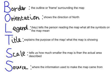
Mapping-BOLTSS!
Mapping activity - completed as a class
| world_map_pdf.pdf |
^ Print out for each student to label. Questions completed as a class
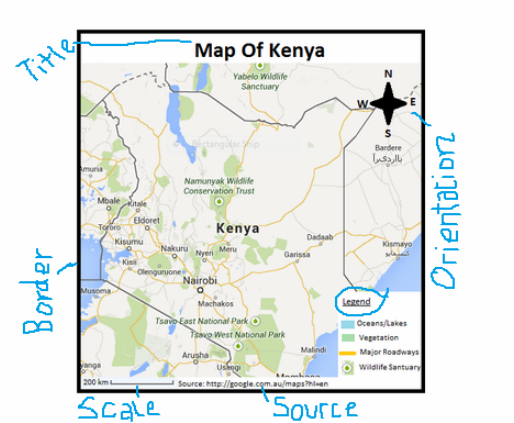
1) Which parts of BOLTSS are missing? (Someone draw these)
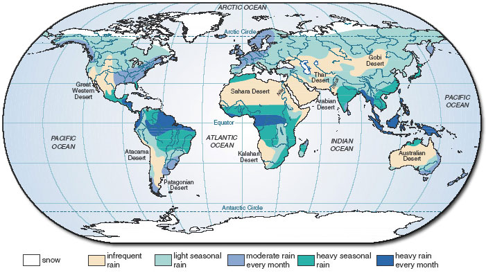
2) The Equator is mapped. Who can identify the Tropic of Cancer and the Tropic of Capricorn?
4) What is longitude & latitude?
3)What do we notice about rainfall in countries along the equator? Why might there be a pattern?
4) What about towards the poles?
5) Lets name the contients. What appears to be the driest? The wettest?
*Independent Activity*
Draw a map of this classroom. Measure the room and apply an accurate scale
Test
1) Which parts of BOLTSS are missing? (Someone draw these)
2) The Equator is mapped. Who can identify the Tropic of Cancer and the Tropic of Capricorn?
4) What is longitude & latitude?
3)What do we notice about rainfall in countries along the equator? Why might there be a pattern?
4) What about towards the poles?
5) Lets name the contients. What appears to be the driest? The wettest?
*Independent Activity*
Draw a map of this classroom. Measure the room and apply an accurate scale
Test
| map_test.pdf |
| map_test_modified.pdf |
